You are here: Home > MAPS
Choose a sub category:
City Maps Nelles Travel Maps Trekking Maps
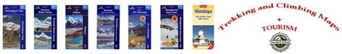
Maps, topographical maps, charts used by hikers, mountain climbers, mountaineers, and travelers.
Sort By:
Page of 13
Alaska Map by Dave Imus Angeles Front Country Trail Map Angeles High Country Trail Map
ALASKA Map 1:3,000,000 scale
Our Price: $14.95
Sale Price: $11.88
Appalachian Trail: 22, the Entire Trail Maps Around Kathmandu Valley NR751 Appalachian Trail: A Trail Pocket Profile AT-01
AT- 02 North Carolina; GA/NC State line thru Fontana Dam, NC AT- 03 Appalachian Trail Pocket Profile NC/TN Great Smoky Mt. Nat. Park AT- 04 appalachian Trail Pocket Profile
Appalachian Trail Pocket Profile  AT- 05 AT-7 Appalachian Trail: Virginia 2 AT-8 Appalachian Trail: Virginia 3 from Pearisburg, VA thru Buchanan, VA
AT-9 Appalachian Trail: Virginia 4 from Buchanan, VA to Rockfish Gap, VA AT-10 Appalachian Trail: Virginia 5 Shenandoah National Park AT-11 Appalachian Trail: Virginia/West VA, Front Royal,VA thru Harpers Ferry. (72 miles)
Appalachian Trail: A Trail Pocket Profile AT- 12 Appalachian Trail: A Trail Pocket Profile AT-13 Appalachian Trail: A Trail Pocket Profile AT-14


Paper Topographic Maps of National Parks

True nature adventurers don't rely on their beloved cell phone or clunky GPS device; they're too busy taking in all of the beautiful surroundings! Topographic maps are your best bet when you need accurate data on where you are and what is surrounding you. You can plan your entire trip from point A to point B on a map and carry it with ease at all times. Backpacking maps can fit in almost any compartment and are easy to understand and use. It's likely that some of your gear has protective casing for these types of maps as well.

We carry just about every type of map for every type of place you'd want to visit. Our topographic lake maps are a favorite among those who enjoy water sports and fishing. Our variety of National Park trail maps and National Park topographic maps make exploring these vast areas a breeze.